How to correct the local origin of the 3d window?
- Mark as New
- Bookmark
- Subscribe
- Mute
- Subscribe to RSS Feed
- Permalink
- Report Inappropriate Content
2022-12-23
10:16 PM
- last edited on
2023-05-09
02:03 PM
by
Rubia Torres
It happens to me sometimes when I want to export the model to google earth.
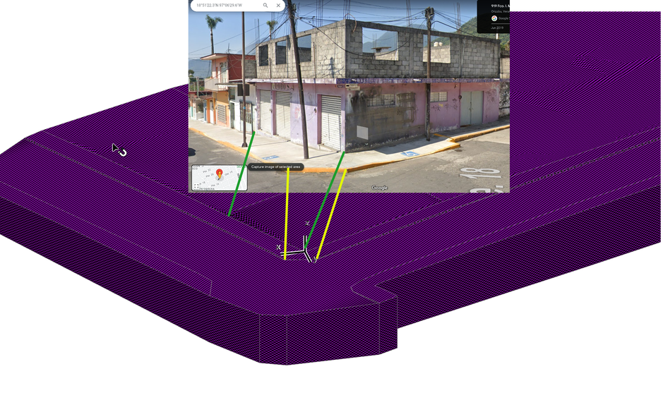
The 2d local origin is misconfigured. I return it to 0 but the origin of the 3d window is displaced. Therefore, when exporting the model, it falls into places that are very far from the origin of Archicad.
Anyone else have happened.?
How have you corrected it?
I double clicked on the user origin, so that it would return to 0,0.
The icon returns, but the coordinate is too far away.
Only the Archicad-google earth workflow is affected.
With the survey point the output to IFC and DWG is correct.
Solved! Go to Solution.
Accepted Solutions
- Mark as New
- Bookmark
- Subscribe
- Mute
- Subscribe to RSS Feed
- Permalink
- Report Inappropriate Content
2023-08-14 11:49 AM - edited 2023-08-14 11:51 AM
Today download the error file. I opened it in archicad 27. I opened the coordinates palette and double-clicked on the user origin.
Check the grid and background data and the origin was set to 0.
Export to google earth and the error was corrected.
Only God and the computer know what happened, but it's already fixed.
- Mark as New
- Bookmark
- Subscribe
- Mute
- Subscribe to RSS Feed
- Permalink
- Report Inappropriate Content
2023-08-10 09:28 AM
Looks like it is woking ok to me ?
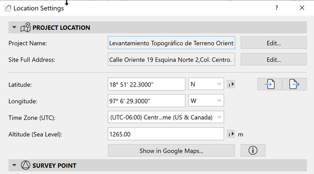
I moved the origin to here: 18°51'22.3"N 97°06'29.3"W and it seems to be correct. ??
ArchiCAD 25 7000 USA - Windows 10 Pro 64x - Dell 7720 64 GB 2400MHz ECC - Xeon E3 1535M v6 4.20GHz - (2) 1TB M.2 PCIe Class 50 SSD's - 17.3" UHD IPS (3840x2160) - Nvidia Quadro P5000 16GB GDDR5 - Maxwell Studio/Render 5.2.1.49- Multilight 2 - Adobe Acrobat Pro - ArchiCAD 6 -25
- Mark as New
- Bookmark
- Subscribe
- Mute
- Subscribe to RSS Feed
- Permalink
- Report Inappropriate Content
2023-08-14 11:42 AM
What happens when you export the model in KMZ to google earth... does it correspond to the coordinate that you changed?
- Mark as New
- Bookmark
- Subscribe
- Mute
- Subscribe to RSS Feed
- Permalink
- Report Inappropriate Content
2023-08-14 11:49 AM - edited 2023-08-14 11:51 AM
Today download the error file. I opened it in archicad 27. I opened the coordinates palette and double-clicked on the user origin.
Check the grid and background data and the origin was set to 0.
Export to google earth and the error was corrected.
Only God and the computer know what happened, but it's already fixed.


