
Turn on suggestions
Auto-suggest helps you quickly narrow down your search results by suggesting possible matches as you type.
Showing results for
EN
Turn on suggestions
Auto-suggest helps you quickly narrow down your search results by suggesting possible matches as you type.
Showing results for
Options
- Subscribe to RSS Feed
- Mark Topic as New
- Mark Topic as Read
- Pin this post for me
- Bookmark
- Subscribe to Topic
- Mute
- Printer Friendly Page
PVBergkrantz
Expert
Options
- Mark as New
- Bookmark
- Subscribe
- Mute
- Subscribe to RSS Feed
- Permalink
- Report Inappropriate Content
2018-11-09
06:06 PM
- last edited on
2023-05-25
04:53 PM
by
![]() Rubia Torres
Rubia Torres
Place mesh from surveyors data detail level
2018-11-09
06:06 PM
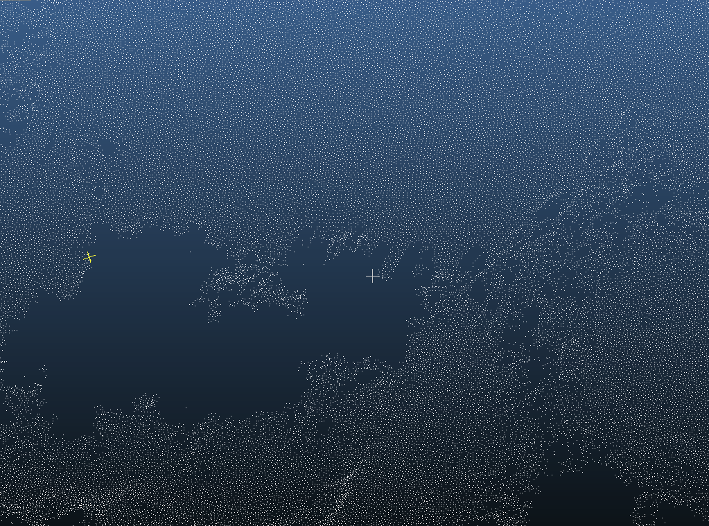
If I put the surveyors unit to say millimeter the same simplification takes place, but now the distance between points are 1 mm (and the model scaled accordingly).
Any ideas on this?
This is the ArchiCAD mesh, with exactly 1 meter between points.
This is the original point cloud, with 0.1 m between points.
| AC 29 Int | Win11 | i7-7800X | 32 GB | GeForce RTX 2060 6GB |
0 Replies 0
Still looking?
Suggested topics
- Door Panels Reverting to Simplified Model View in Libraries & objects
- Placed elevation views using the surface texture fill, shaded option in Documentation
- Importing Surveyors Data into Archicad in Modeling
- Choosing Between Intel Core i9-14900KF and AMD Ryzen 9 7950X for Large Archicad Projects in Installation & update
- Stair 'draining' display in plan in Modeling
